
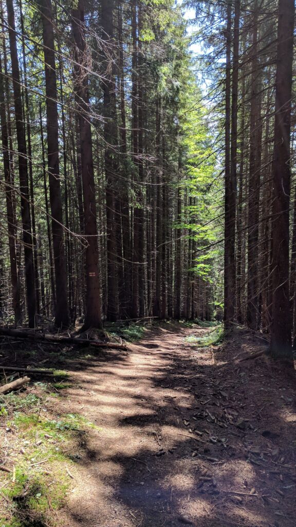
Most visitors who ask about hiking near Antalya are pointed straight to the Lycian Way, and fairly enough, it’s the famous one. But there’s a second long-distance trail that starts almost as close to the city and gets a fraction of the attention: the St Paul Trail. It follows the route tradition holds that the apostle Paul walked on his first missionary journey, climbing from the Mediterranean coast at Perge up into the Taurus Mountains to Lake Eğirdir. It’s wilder, higher, and considerably tougher than the Lycian Way, and that’s exactly why some hikers prefer it.
📝 A Local’s Note
Don’t compare this to a beach-town Lycian Way section and expect the same convenience. Villages and pensions thin out fast once you’re up in the mountains, and mobile signal drops out in places, so this needs more planning than a casual Ölüdeniz-Kabak walk, proper maps or a downloaded GPS track, not just paint blazes.
The easiest realistic taste of the trail from Antalya is the Köprülü Canyon branch starting at Beşkonak, about 80km from the city. You can combine a short stretch of the trail with the rafting and canyon activities already based there, rather than committing to the full high-mountain route.
What is the St Paul Trail?
The St Paul Trail is a waymarked long-distance walking route of around 500km, running from Perge (just east of Antalya) up to Yalvaç, near Lake Eğirdir and the ancient site of Pisidian Antioch. A second starting branch begins at Beşkonak, the entrance to Köprülü Canyon National Park, about 80km northeast of Antalya. The route follows a mix of old Roman roads, footpaths and forest tracks, and is maintained and waymarked by the Culture Routes Society, the same organisation behind the Lycian Way.
How it compares to the Lycian Way
This is the trail’s whole identity: it’s the harder, higher, less-visited alternative. Where the Lycian Way mostly hugs the coast at low elevation, the St Paul Trail climbs from sea level to around 2,200 metres, with two optional peak detours reaching roughly 2,800 metres. Villages and pensions are more spread out, so multi-day stretches often require camping rather than the pension-to-pension system that makes the Lycian Way approachable. In exchange, you get genuine mountain scenery, pine and cedar forest, high plateaus, and a lot more solitude than the busier Lycian Way sections ever offer.
| St Paul Trail | Details |
| Length | ~500km, around 27 days end to end |
| Start / end | Perge (near Antalya) or Beşkonak → Yalvaç / Lake Eğirdir |
| Elevation | Sea level up to ~2,200m (optional peaks ~2,800m) |
| Best season | Spring and autumn; avoid July-August heat at low elevation and check snow at altitude in early spring |
| Accommodation | Village pensions on some stretches, camping needed on others |
| Difficulty | Harder than the Lycian Way, more remote, more elevation gain |
Trying a short section from Antalya
You don’t need 27 days to get a feel for it. The most accessible starting point from Antalya is Perge itself, where the trail begins right at the ancient city’s edge, a first short stretch is walkable as a day outing before the route climbs into the hills. The Beşkonak branch at Köprülü Canyon is the other practical entry point, and it’s already a popular day-trip area for whitewater rafting, so a short trail walk pairs naturally with a canyon visit. Either way, treat a first attempt as a half-day or day walk, not a multi-day commitment, until you know what the terrain and your own pace feel like.
Waymarking and navigation
Like the Lycian Way, the trail uses red-and-white paint blazes, and the Culture Routes Society maintains the marking, but coverage is inconsistent the further you get from the more-visited southern sections. Given the remoteness of much of the route and the real elevation involved, download a GPS track (Wikiloc has St Paul Trail tracks) before setting out on anything beyond a short, well-marked section near Perge or Beşkonak, and don’t rely on paint blazes alone once you’re properly into the mountains.
Frequently Asked Questions
How long is the St Paul Trail?
Around 500km, typically taking about 27 days to walk end to end from Perge to Yalvaç.
Is the St Paul Trail harder than the Lycian Way?
Yes. It climbs to around 2,200m with optional peaks near 2,800m, is more remote, and requires more camping, compared to the Lycian Way’s mostly low-elevation, pension-served route.
Can I walk just part of it from Antalya?
Yes. Perge, where the trail begins, and Beşkonak at Köprülü Canyon are both easy day-trip starting points for a short taste of the route.
When is the best time to hike it?
Spring and autumn. Summer brings excessive heat at lower elevations, and early spring can still have snow at altitude.
Does it really follow the route the apostle Paul walked?
It’s inspired by and loosely traces the region of Paul’s first missionary journey as described in the Book of Acts, connecting Perge to Pisidian Antioch near Yalvaç, though it’s a modern waymarked trail rather than an exact historical reconstruction.
More hiking and nearby sites: see our Lycian Way trekking guide, Köprülü Canyon guide, Perge Ancient City guide, and Termessos guide.
Page last updated: September 2026.
🚗 Need a Private Transfer or Luxury Vehicle in Antalya?
We arrange private airport transfers, intercity transfers and luxury vehicle hire across the Antalya region. Message us on WhatsApp for a quick quote.
💬 WhatsApp +90 533 653 02 90